


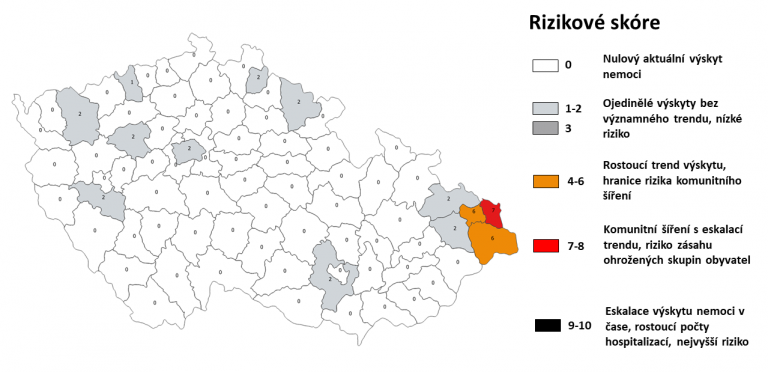
A new map published on the Ministry of Health website provides up-to-date information on the risk of coronavirus transmission by district. The map will be updated every day based on the most recent data. Image: MZCR.
Czech Rep., Jul 1 (BD) – The Ministry of Health has released a map showing the Covid-19 transmission risk for each district of the Czech Republic. The map will be updated every day based on all available data, including growth in number of cases, number of people hospitalised, and other recent trends. The level of risk will determine whether the reintroduction of anti-coronavirus measures is required.
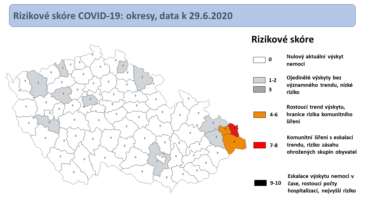
Each district is given a score out of ten evaluating the local risk of transmission, which corresponds to one of six colours, from white (negligible risk) to black (very high risk, including community transmission and rising number of hospitalisations). Currently, all districts in the Czech Republic are at a very low risk of infection, apart from three districts at the far eastern end of the country near the Polish border, around the mining town of Karvina.